Ancient landslide destroyed area size of Cincinnati
By understanding dynamics of landslides, researchers hope to prevent future ones

University of Cincinnati geologists reconstructed a massive landslide in Nevada that wiped out an area the size of a small city more than 5 million years ago.
UC College of Arts and Sciences graduate Nick Ferry and UC assistant professor of geology Daniel Sturmer pieced together details of the Blue Diamond landslide, a natural disaster that sent rocks and boulders tumbling more than 6 miles across what is now a desert outside Las Vegas.
The landslide in Red Rock Canyon National Conservation Area had such mass and force that it propelled fragmented rock 2 miles uphill, cresting the enormous Blue Diamond Hill, and flattened an area larger than downtown Cincinnati. Rubble from the landslide stretches over an area of more than 7 square miles.
“You can imagine this being pretty catastrophic in nature,” said Ferry, now a doctoral student at the University of Kansas.
The study was published in the Journal of Sedimentary Research.
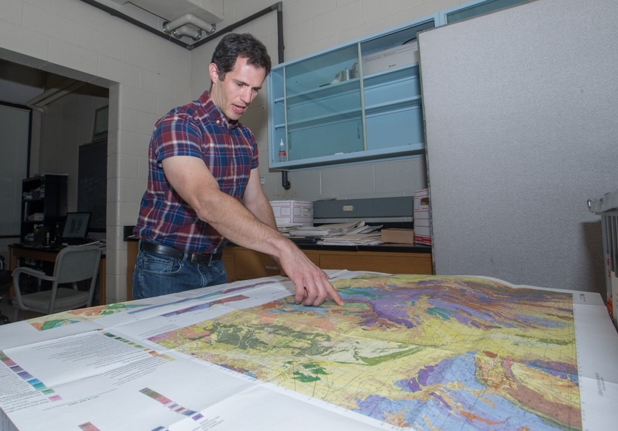
UC geologist Daniel Sturmer studied a massive ancient landslide in Nevada to learn more about ways to predict future disasters. Photo/Joseph Fuqua II/UC
The Blue Diamond catastrophe was a rock avalanche, an extremely rapid landslide that propelled fragmented rock and soil downhill at more than 5 meters per second.
Piecing together details of a landslide that occurred millions of years ago is a challenge, but geologists use a combination of field observations and laboratory analysis. By learning more about these natural disasters, researchers hope to find ways to predict future ones.
That’s becoming increasingly important as people build homes, schools and businesses in more precarious places, Sturmer said.
“Landslides are one of the major disasters in the world in areas where you have significant topography, which represents a growing percentage of where people live,” Sturmer said. “It’s critical to be able to predict these hazards and prevent them or at least be smart about construction when you’re expanding cities.
“It’s one of the critical things geoscientists are doing.”
Philosophically, the way I think about landslides is that they heal the surface of the Earth. They’re big agents of change.
Daniel Sturmer, UC assistant professor of geology
Ferry said the landslide might have been triggered by heavy rain. This part of Nevada was much wetter millions of years ago than it is today.
“We believe one reason the landslide reached so far is because it was flowing over saturated substrate, which reduced the friction resistance,” Ferry said.
Determining the date of a landslide is a little tricky. Researchers can use radiocarbon dating for events that occurred less than 50,000 years ago. For older events, they can turn to cosmic ray exposure dating. Researchers can tell how long a rock has been exposed on the surface of the Earth by studying the isotopes of certain elements in the rocks that were affected by high-energy cosmic rays. It’s a tool also used to study the movement of glaciers.
Tracking an epic disaster
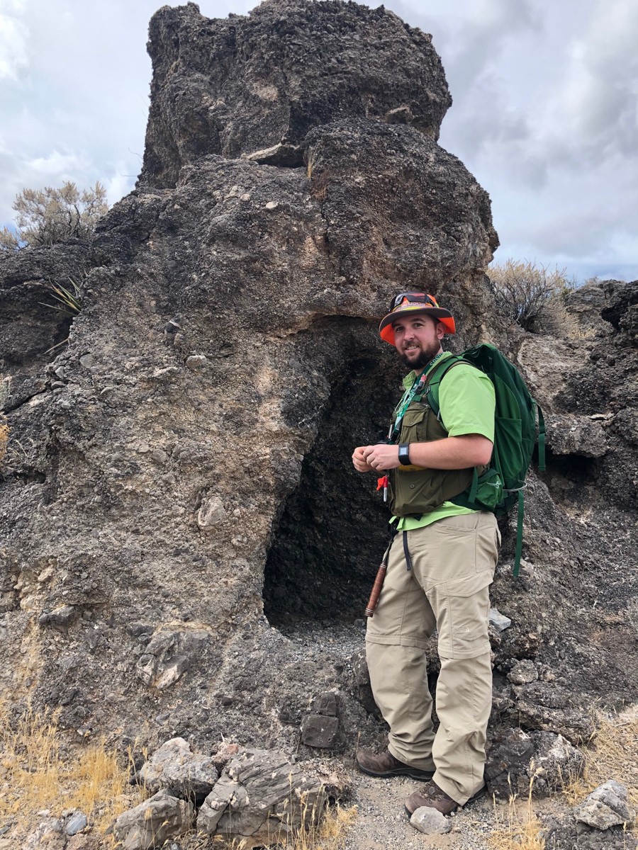
While studying geology at UC, Nick Ferry was able to conduct fieldwork in Nevada. He said this research experience was one of the highlights of his time at UC. Photo/Daniel Sturmer
UC researchers say the Blue Diamond landslide occurred sometime between 5 million and 23 million years ago during the Miocene Period. This was a period of rapid evolutionary diversity. One Miocene bird, Argentavis, found in South America weighed as much as 200 pounds and had a wingspan of 23 feet.
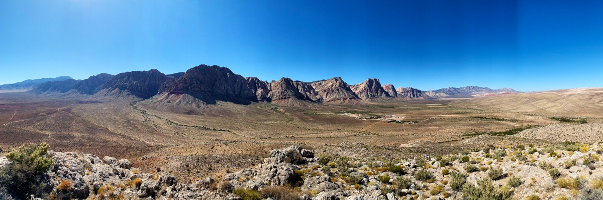
The landslide originated in the Wilson Cliffs, which today stand about 6,500 feet above sea level but were probably much higher at the time of the disaster. Material ended up 6 miles away atop Blue Diamond Hill which today stands at 4,931 feet above sea level. Sturmer said it’s possible that this hill has moved over the millennia through plate tectonics.
Regardless, the landslide would have scarred the Earth in thunderous, dramatic fashion.
“Philosophically, the way I think about landslides is that they heal the surface of the Earth. They’re big agents of change,” Sturmer said. “Plate tectonics creates these mountains with enormous potential energy. And they’re worn down by erosion and from these landslide events that reduce that potential energy.”
The study was supported by the American Chemical Society’s Petroleum Research Fund and grants from the Association of Environmental and Engineering Geologists.
Understanding Cincinnati's landslide risks
Landslides aren’t just a concern in mountainous regions. Cincinnati is extremely susceptible to landslides, Sturmer said.
Ohio’s Department of Transportation monitors and inspects more than 10,000 identified landslide-prone areas across the state. Each is rated for public risk based on its history and hazard to motorists, among other factors. The highest risk landslides are inspected each year.
“The hills in the Cincinnati area are the reason that we are so susceptible to landslides,” Sturmer said.
Ice Age glaciers created Cincinnati’s topography through erosion by streams and rivers that carved steep hills and valleys. Likewise, deposits from the glacier are typically loose and full of weak clays, Sturmer said. When this gets wet from heavy rain or melting snow, the hillsides can be prone to landslides, he said.
“The combination of steep-sided valleys, clay-filled, unconsolidated sediment and wet climate make the Cincinnati area one of the most landslide-prone metro areas in the country,” Sturmer said.
Geologists monitor hillsides that could threaten public safety or infrastructure and study the historical record to see if these steep hills have failed before, he said.
Sturmer said geologists look for telltale warning signs of landslide development such as crescent-shaped cracks on high slopes or the slight tilt of power poles, fence posts or trees. They also look for evidence of previous slides such as bumpy, irregular slopes or cracks in buildings or foundations and plumbing. The hillsides might have curved tree trunks from where the ground shifted or long debris scars stretching downhill, he said.
“You can see many of these features on hillsides driving around town,” he said.
Ferry said he was excited to do fieldwork as a UC geology student.
“Getting out to Nevada to see the massive scale of this landslide was amazing,” Ferry said. “As a geology student, you’re not limited to just studying geology locally. You can travel to places where you can do research that interests you.
“It was invaluable in making me a better geologist,” he said.
Featured image at top: A view of the Wilson Cliffs from Blue Diamond Hill. Photo/Nick Ferry
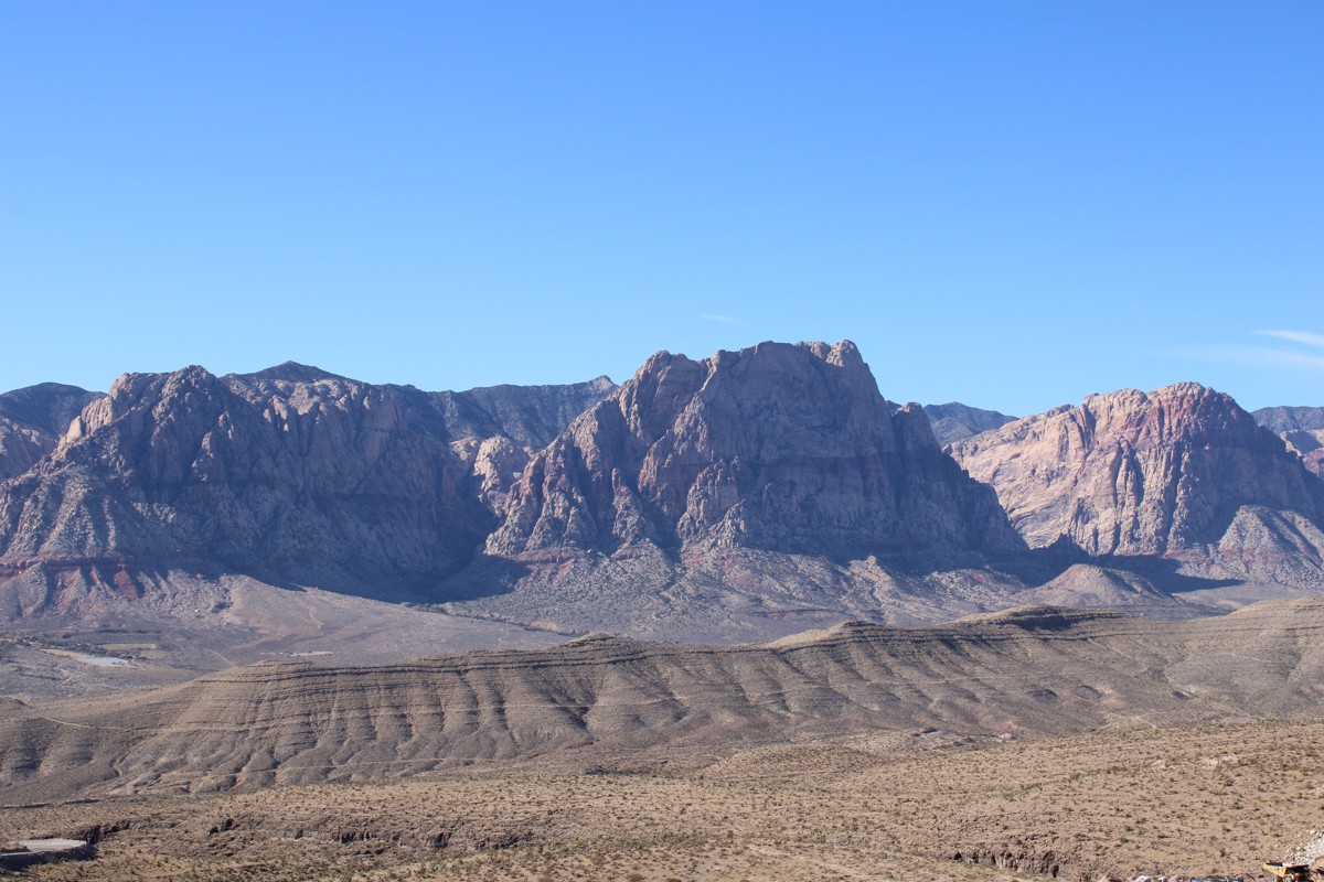
The landslide originated in a place called the Wilson Cliffs, which is likely far more weathered and eroded than it was more than 5 million years ago. Photo/Nick Ferry
Learn By Doing
UC students literally get a chance to get their hands dirty by participating in original research around the world. UC geology students have conducted fieldwork from Yellowstone National Park to Thunder Bay, Ontario. At UC, students learn by doing, taking experiential learning to the next level through peer-reviewed research. Learn more about UC's career education.
Related Stories
Pocket-sized population threat
May 18, 2026
The Financial Times took a deep dive into why populations around the world continue to be on the decline. The publication cited new University of Cincinnati research as part of the investigation that looks at the fall of fertility in the digital era.
Fire Awards spotlight innovation ecosystem at UC 1819 Innovation Hub
May 18, 2026
The Cincinnati Business Courier held its Fire Awards at UC’s 1819 Innovation Hub to highlight the region’s fast-growing startups and broader innovation community.
UC finds integrating substance use disorder treatment into clinic-based internal medicine expands access to care
May 18, 2026
A University of Cincinnati primary care teaching clinic integrates substance use disorder treatment into resident training, expanding access to addiction care and boosting physician confidence.