Mongabay: Forest loss moves swiftly at 50% deforestation 'tipping point'
UC geography professor Tomasz Stepinski found that landscapes trend toward homogeneity over time

The nonprofit conservation news service Mongabay was among the many news outlets around the world that examined University of Cincinnati research showing a "tipping point" for deforestation.
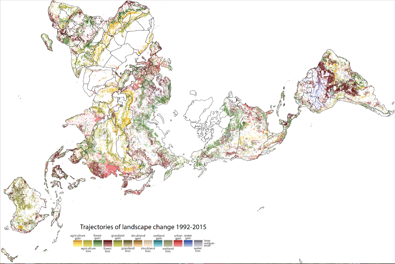
Geography professor Tomasz Stepinski in UC's College of Arts and Sciences used high-resolution satellite images from the European Space Agency to study landscapes in 9-kilometer-wide blocks across every inch of the planet between 1992 and 2015. He found that deforestation occurs comparatively slowly in these blocks until about half of the forest in a block is gone. Then the remaining forest disappears very quickly.
The study was published in the journal Geophysical Research Letters.
Stepinski also observed an intriguing phenomenon in the way people are changing the planet. His research showed that very few blocks were mixed landscapes such as forest and agriculture or agriculture and urban development. And those that were mixed didn't stay mixed for long.
"Planet Earth wants to be homogeneous. The land wants to be the same in all these patches," Stepinski said. "And when they start to change, they don't stop until they convert everything into another homogeneous block."
UC geography research in the news
- ZME Science: There's a deforestation 'tipping point' past which trees disappear quickly
- Environmental News Network: UC Study Finds Tipping Point in Deforestation
- Ecoticias (Spain): Geographers find point of no return for deforestation
- Outlook India: Landscape change may happen very rapidly after forests lose half their cover
- Inside Ecology: Study finds tipping point in deforestation
- Futura Sciences (France): Deforestation: An identified point of no return
- Science Daily: Geographers find tipping point in deforestation
- Daily Excelsior (Kashmir): Landscape change may happen very rapidly after forests lose half their cover
Featured image at top: UC geography professor Tomasz Stepinski used satellite images to track landscape change across the planet from 1992 to 2015. The data shows mixed landscapes don't stay mixed for long. Graphic/Tomasz Stepinski

UC professor Tomasz Stepinski creates maps that change the way we think about the world. Photo/Andrew Higley/UC Creative Services
Next Lives Here
The University of Cincinnati is classified as a Research 1 institution by the Carnegie Commission and is ranked in the National Science Foundation's Top-35 public research universities. UC's graduate students and faculty investigate problems and innovate solutions with real-world impact. Next Lives Here.
Become a Bearcat
- Apply online or get more information about undergraduate enrollment by calling 513-556-1100.
- Learn more about UC's many undergraduate and graduate programs.
Related Stories
Telescope captures information about lonely Jupiter-like gas giant
May 13, 2026
Science outlets highlight a University of Cincinnati student's collaborative discoveries about an exoplanet 901 light years away.
University of Cincinnati graduate programs rise in national rankings across high-demand fields
May 13, 2026
University of Cincinnati graduate programs climbed in the latest U.S. News & World Report rankings, led by strong gains in workforce-focused fields including public health, clinical psychology and business.
UC archaeologist receives 2026 Athens Prize
May 13, 2026
University of Cincinnati archaeologist Jack L. Davis received the 2026 Athens Prize from the American School of Classical Studies at Athens during its annual gala May 7 at Gotham Hall. The award recognizes scholars whose work has significantly advanced knowledge of ancient Greece, a distinction that reflects Davis’ decades-long impact on the field of Aegean archaeology.