Secret weapon to stop invasive species: satellites
Bane of gardeners and foresters alike, Amur honeysuckle can be identified from space
One common invasive species is so widespread that you can see it from space.
The University of Cincinnati found that satellite imagery can identify nonnative and invasive Amur honeysuckle, an ornamental shrub introduced from Asia that has spread in forests across much of the United States.
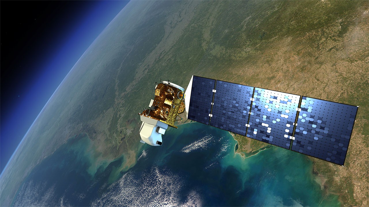
UC graduate Bridget Taylor, UC biology professor Denis Conover and UC geography professor Richard Beck used satellite imagery to find nonnative invasive Amur honeysuckle in several urban parks and cemeteries from space. Using one of the satellites in a series of Earth-observing missions jointly managed by NASA and the U.S. Geological Survey, the Landsat-8 satellite can measure the reflection of wavelength energy in the red and near-infrared bands. The ratio of the two wavelengths helps scientists identify foliage of different plants from orbit.
UC found that the method was effective in detecting Amur honeysuckle, according to a study published in the journal Ecological Restoration.
The study gives conservationists and land managers another tool to fight invasive species and demonstrates UC's commitment to research as described in its strategic direction called Next Lives Here.

Amur honeysuckle greens up earlier in the spring and stays green later into the fall after native plants have dropped their leaves. Here it is leafing out in April. Photo/Denis Conover
Amur honeysuckle bushes grow in thick patches, often crowding out and outcompeting other plants in a forest’s understory. It has an extended growing season, leafing out earlier and staying green far later in the year than many native trees and shrubs.
UC used Landsat-8 images to examine five urban forests in Greater Cincinnati. The goal: to develop an inexpensive and efficient remote mapping approach for ecological restoration in urban forests.
Then they used global-positioning satellites to corroborate their mapping observations on the ground. They found that their maps were 82% accurate.
“The fact that it was possible to use the satellite imagery in an urban setting was pretty unique,” said Taylor, the study’s lead author.
Amur honeysuckle has a chance to green up and leaf out sooner than native plants, so native wildflowers often get killed off when they’re growing under it.
Bridget Taylor, UC geography graduate
“Urban areas have a lot of noise in satellite imagery. So it’s harder to identify specific details,” she said.
Taylor’s research served as her undergraduate geography capstone project.
“Bridget put an enormous amount of time into the analysis. I’m really impressed with her work,” Beck said.
Taylor has participated in efforts to eradicate the nonnative Amur honeysuckle in places like Burnet Woods, the park adjacent to UC’s Uptown campus.
“It’s very bushy. Birds like to eat the berries and spread the seeds,” she said. “Amur honeysuckle has a chance to green up and leaf out sooner than native plants, so native wildflowers often get killed off when they’re growing under it.”

In places like Bender Mountain Nature Preserve where Amur honeysuckle has been eradicated, native wildflowers thrive. Photo/Gary Taylor
After graduating in 2016, Taylor worked for the Nevada Division of Forestry where she continued public efforts to eradicate invasive species to protect sensitive desert habitats. Today, she monitors water quality on the Ohio River as an environmental scientist for the Ohio River Valley Water Sanitation Commission.
Taylor said the study shows that satellite images can provide an effective, inexpensive alternative to using drones or ground surveys to identify larger patches of the invasive bushes for ecological restoration.
“It’s important to know the spatial coverage so you can know where best to put your time and energy,” she said.
Co-author Conover said satellite imagery could be useful in locating other nonnative invasive species such as English ivy and wintercreeper that stay green throughout the year and climb trees.
Featured image at top: An artist's rendering of a Landsat satellite floating over the Pacific Ocean. NASA launched the first Landsat satellite in 1972. Illustration/NASA-Goddard

UC graduate Bridget Taylor conducts field research with UC professor Denis Conover and Conover's dog, Abigail. Photo/Richard Beck

Amur honeysuckle dominates the understory of Bender Mountain Nature Preserve along the Ohio River. Photo/Gary Taylor
More UC geography news

The ancient Maya city of Tikal. Photo/David Lentz
- Ohio's COVID-19 experience offers lessons
- UC finds ancient Maya reservoirs contained toxic pollution
- UC experts' Maya research featured in Cincinnati Museum Center exhibit
- Residents in some Ohio counties face greater risk from COVID-19
- UC study finds tipping point in deforestation
- UC identifies Ohioans most at risk of opiate overdose
Impact Lives Here
The University of Cincinnati is leading public urban universities into a new era of innovation and impact. Our faculty, staff and students are saving lives, changing outcomes and bending the future in our city's direction. Next Lives Here.
Stay up on all UC's COVID-19 stories, read more #UCtheGood content, or take a UC virtual visit and begin picturing yourself at an institution that inspires incredible stories.
Related Stories
Small business predictions for 2026
January 8, 2026
In 2026, small business leaders will likely adapt to AI and cybersecurity threats as they consider new funding sources, training strategies and realities in today’s business environment.
World class: Alumni travel program connects Bearcats on global scale
January 7, 2026
Most people have a natural curiosity to see the world. Meanwhile, most Bearcats enjoy being around other Bearcats. Alumni can check both boxes through the UC Alumni Association’s travel program, which offers about half a dozen excursions each year to fascinating places around the globe.
UC launches Bearcat Affordability Grant
January 7, 2026
The University of Cincinnati is making college more attainable for students across Ohio with the creation of the Bearcat Affordability Grant. The new grant will provide a pathway to tuition-free college for students of families who make less than $75,000 per year. Beginning in fall 2026, the Bearcat Affordability Grant will cover the remaining cost of tuition for Ohio residents who are Pell eligible.
